EPA Releases New Tool For Mapping Ecosystem Services
Payments for ecosystem services rely on data that’s both trustworthy and accessible, but they’re often dogged by data that lacks both. Last week, the US Environmental Protection Agency unveiled a tool that delivers on the accessibility and transparency fronts by providing an incredibly easy-to-use interface for accessing more than 300 separate data layers.
While the National Mitigation and Ecosystem Banking Conference was winding down in Denver, the US Environmental Protection Agency was unveiling a new tool for mapping ecosystem services across the country.
12 May 2013 | WASHINGTON, DC | Payments for ecosystem services rely on data that’s both trustworthy and accessible, but they’re often dogged by data that lacks both. Last week, the U.S. Environmental Protection Agency (EPA) unveiled a tool that delivers on the accessibility and transparency fronts by providing an incredibly easy-to-use interface for accessing more than 300 separate data layers of geographic, demographic, and environmental data across the United States.
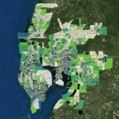
Developed in collaboration with other federal and state agencies, including the the US Geological Survey and the US Forest Service, as well as universities and non-governmental organizations (NGOs), EnviroAtlas creates a map-based interface onto which data from an exhaustive matrix can be overlaid and analyzed.
The tool is designed to be scaled up as more data become available, and to shine a light into the data itself, which should flush weaknesses and shortcomings out into the open. It also lets users generate customized maps and images that show the condition of their local community’s air, water, and landscape; as well as population density and other demographic data. Users can investigate land cover patterns, see how ecosystem services reduce pollution, and view closer to true scale data to compare them across selected communities.
It can be used for everything from planning urban parks to identifying the best location for a new park to mapping the impacts of a new road.
“Our health and well-being, our economy and our security depend upon healthy ecosystems,” says Bob Perciasepe, Deputy Administrator of EPA, “By providing EnviroAtlas, which contains a wealth of information for the United States, EPA is helping to ensure that anyone making decisions that may impact ecosystems will have the best available knowledge to build prosperous communities while conserving our natural resources.”
Please see our Reprint Guidelines for details on republishing our articles.